Rock on down to a geopark near you
By Mark Brazil | Jun 17, 2012
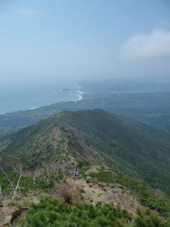
For the view alone it offers of the Pacific coastline south to spectacular Cape Erimo, it’s worth the easy trek up this peak near the southern end of the rugged Hidaka range — while its wealth of wildflowers are an unforgettable bonus.
But what makes Apoi-dake (as it’s known in Japanese) particularly special is the fact that, despite its low altitude, plant and animal species more commonly associated with higher peaks can be found there.
Perhaps most unusual among these is the Northern Pika, known locally as naki-usagi (lit. “singing rabbit”) — a member, like rabbits and hares, of the zoological order Lagomorpha. Today, these small plant-eaters are most likely encountered in the 2,000-meter-plus Tokachi and Daisetsu ranges of central and east-central Hokkaido, respectively, but those on Mount Apoi are at the species’ most southerly location in Japan, and at about its lowest altitude.
After the last Ice Age in Japan around 14,000 years ago, the Northern Pika’s range was undoubtedly wider and lower in Hokkaido, but since then they have been in retreat — ever upward in both altitude and latitude. They favor boulder-strewn slopes, but such places have mostly long ago been overgrown by forest creeping up higher in the mountains as the climate has warmed.
Despite hiking many of Hokkaido’s peaks, I had not previously been tempted by Mount Apoi — not because it lacked particular attractions, but because it didn’t satisfy my own rigorous formula. I am a great believer in spending more of a day at a location, or enjoying an activity at that location, than it takes to travel there and back. So, being some three hours by road from my home base in Ebetsu, Mount Apoi’s lowly peak had never made the cut — until, that is, last month.
Then, in the company of an avid wildflower photographer, I set off soon after dawn on the three-hour drive to the trailhead with thoughts of flowers and birds very much in my mind. Little did I expect that I would spend seven hours on the mountain (hence satisfying my self-imposed conditions: seven hours at the destination for six hours’ traveling), see so many flowers and birds — and leave with a whole new perspective on ecotourism.
On May 17, the day in question, I was surprised by how mild it was in southern Hokkaido, and also by the paradoxical fact that spring blooming seemed somehow late.
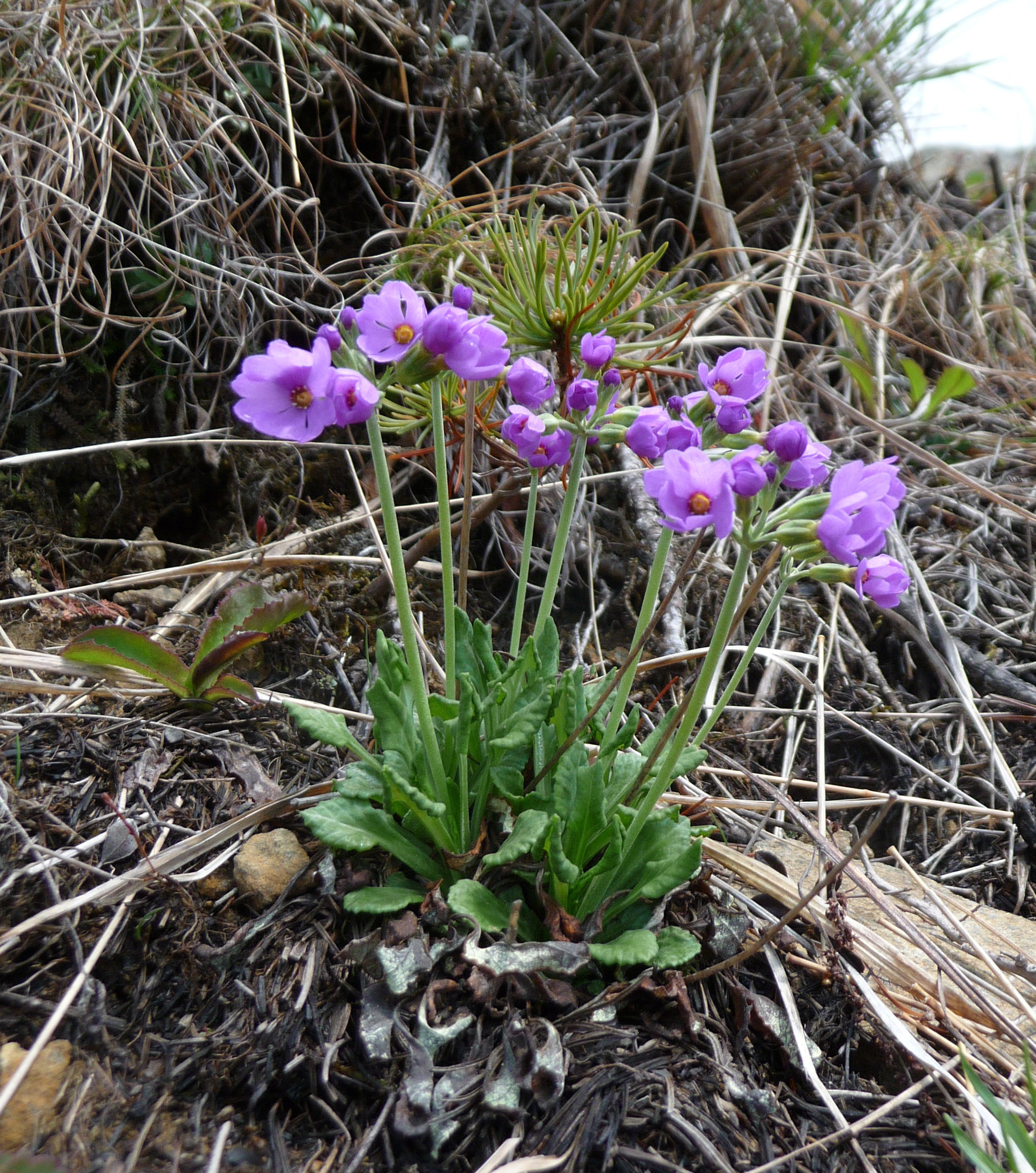
The early flowers on the mountain were almost exclusively purple or pink, mostly purple violets and primulas, but the forest was a pleasant mixture of deciduous trees and conifers, even including some pines — a genus I don’t normally associate with Hokkaido except in the extreme south and southwest.
Summer migrant birds had arrived and were holding territory, with gaudily colored Narcissus Flycatchers in evidence, Eastern Crowned Warblers wheezing their simple songs, Oriental Cuckoos providing a rhythmic “hoop-hoop, hoop-hoop” in the background and the resident woodpeckers, including Japan’s largest, the Black Woodpecker, evidenced by their calls and tapping.
A Siberian Chipmunk, perhaps fresh from hibernation, decided to show itself well and allowed me to photograph it. I found signs of Red Fox scattered along the trail, and there were plentiful indications (hoofprints and droppings) of Sika Deer. Though I didn’t actually glimpse a deer that day, it was clear that very many were in residence.
For their presence we must thank Hokkaido’s Utari. As legend has it, in the past there were no deer in this area, but as the animals could be an important source of food and other materials for the local people, they decided to send a message to the gods in the hope they would be rewarded with the deer they craved. So it was that they built a great pyre on the peak of what became known as Ape-o-i-nupuri (The Mountain of the Big Fire) to attract the gods’ attention. Their prayers bore fruit, and today the area not only supports many deer, but it takes its Mount Apoi name from a convoluted contraction of “The Mountain of the Big Fire” in the Ainu language.
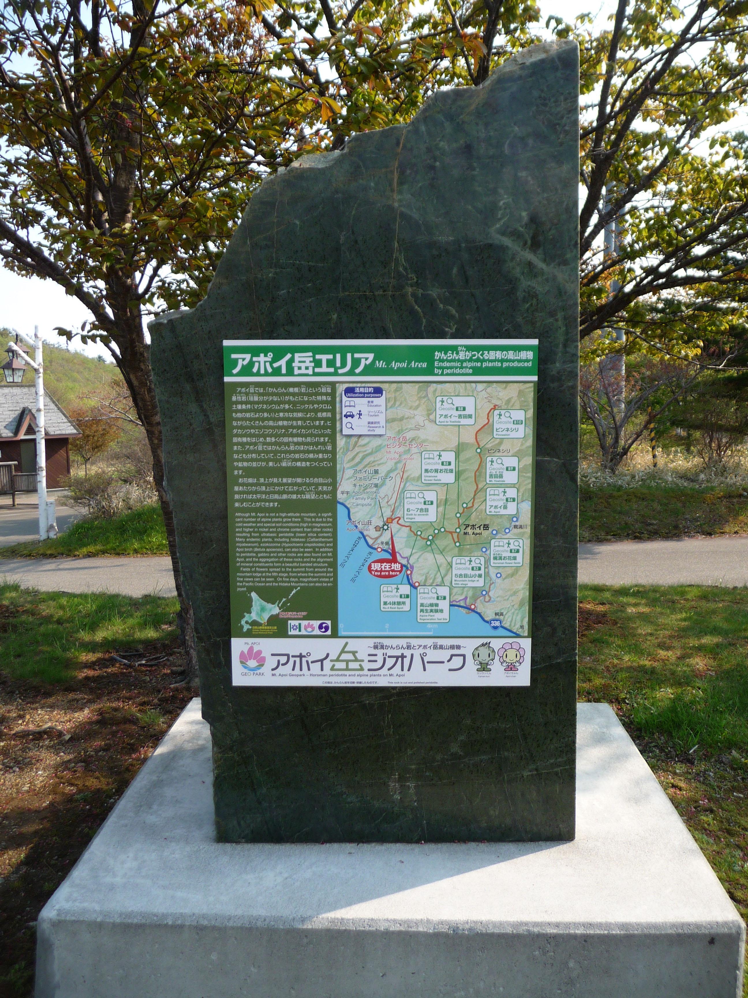
But my greatest surprise on that May day — beyond how much I enjoyed hiking the mountain — was to discover that, since 2009, Mount Apoi had been officially included in the Japanese Geoparks Network.
When I first saw a reference there to that network, a bell rang in my memory and I recalled visiting the extraordinary Yehliu Geopark on the northern coast of Taiwan in mid-April 2010, and thinking: “Geopark. What’s that?”
The timing of my visit to Mount Apoi was serendipitous not only because it reminded me of my ignorance of geoparks, but because a few days before — from May 12-15 — Japan hosted the 5th International UNESCO Conference on Geoparks, at the Unzen Volcanic Area Global Geopark in western Kyushu. Although the event attracted nearly 600 people from 31 countries, I somehow completely missed hearing about it.
Don’t be surprised if you missed the news of it, too, as geoparks haven’t yet received the kind of grassroots attention of the roughly 6,500 national parks established worldwide since Yellowstone, in the U.S. states of Wyoming, Idaho and Montana, paved the way when it was established in 1872.
Nowadays, these national parks serve not only as crucial protected areas for landscape and wildlife conservation, but also as focal points for recreation and tourism — something that geoparks are also beginning to do. In fact the Global Geoparks Network (GGN) founded in 1998 under the wing of UNESCO’s Ecological and Earth Sciences Division aims to promote the conservation of geological heritage, and to encourage sustainable tourism, research and development focused on it, in just the same ways that national parks do.
The first-ever international conference on geoparks was held as recently as 2004, in Beijing. By 2012, though, the network had spread across 27 countries and had 89 member locations. Befitting its hosting of the inaugral conference, China leads the field with 26 designated geoparks. However, a quick search of the Internet reveals how patchy and inconsistent is the available information, making it difficult to ascertain both the most recent worldwide figures and whether particular sites are recognized only nationally or internationally.
The Japan Geopark Committee was established in 2008, and on Aug. 22 the following year, the nation’s first three GGN-registered geoparks came into being — comprising the Unzen volcanic area; the Toya caldera and Usu volcano in Hokkaido; and Itoigawa in Niigata Prefecture. Since then, two more GGN geoparks have been added to Japan’s tally — San’in Kaigan in Tottori Prefecture and Muroto in Kochi Prefecture, Shikoku.
For a nature-focused visit to learn about the geological forces at work shaping our Earth, all five of these globally recognized goeparks are sure to offer ample rewards — as are another nine areas listed nationally rather than globally. These latter areas include Mount Apoi in southern Hokkaido; Shirataki in northern Hokkaido; Oshima in the Tokyo-administered Izu Islands; Dinosaur Valley Fukui Katsuyama in Fukui Prefecture; the Southern Alps spanning Nagano, Yamanashi and Shizuoka prefectures; the Oki Islands of Shimane Prefecture in the Sea of Japan; Mount Aso in Kumamoto Prefecture, Kyushu; the same prefecture’s Amakusa and Goshoura islands in the East China Sea; and Kirishima in Kagoshima Prefecture, Kyushu.
Situated where four tectonic plates converge and collide, and with innumerable volcanic areas, Japan is especially complex geologically and is surely deserving of more geoparks. For instance, I wouldn’t hesitate to promote the Akan volcanic area of southeastern Hokkaido, including lakes Akan, Kussharo and Mashu, as being both geologically and scenically exciting.
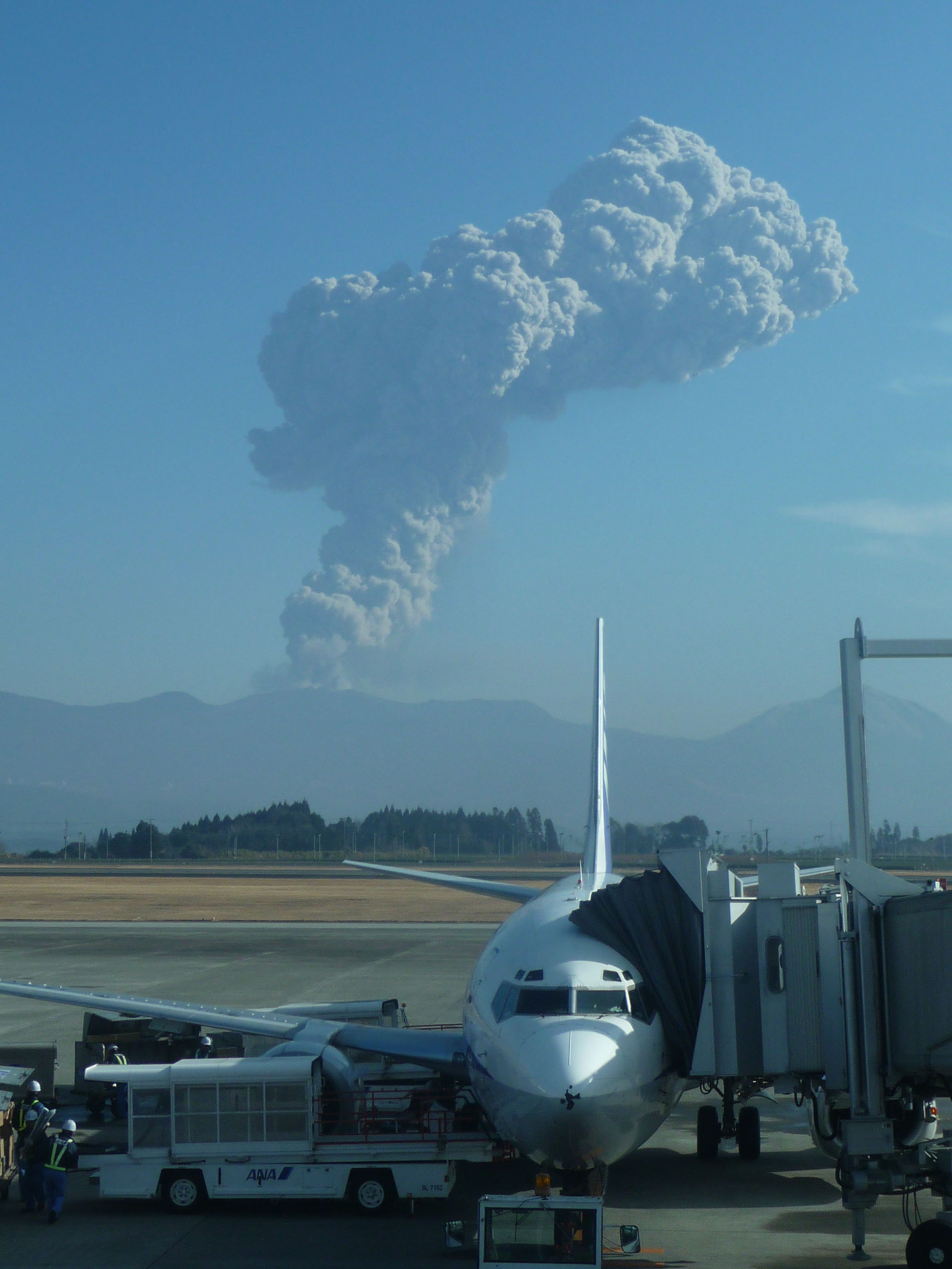
I began my exploration of Japan’s geoparks on Mount Apoi, part of whose uniqueness stems from the fact that in the collision of two crustal plates that thrust up the Hidaka Mountains 13 million years ago, some mantle material was extruded onto the surface.
The Earth’s mantle is almost invariably overlaid by crustal material, but here, at Mount Apoi, ancient deep rocks lie at the surface and it is the resulting variation in the mineral content of soils across the mountain that drives the diversity in its vegetation.
The combination of the mountain’s soils, its climate and geographic position close to the coast, where it is affected both by strong winds and cold sea fogs, means that despite its low altitude, Mount Apoi supports alpine vegetation. It was the uniqueness of its alpine plant communities that caused it to be designated by the national government as a special natural monument in 1952.
Unfortunately, though, that designation has not prevented devastating raids by flora poachers targeting its rare and even endemic species. Nevertheless, Mount Apoi and Japan’s other geoparks present a wonderful opportunity to experience the outdoors and to learn about the overwhelming forces at work shaping the nation’s spectacular landscapes.